Selangor, Malaysia
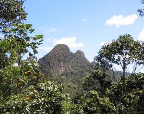
Bukit Tabur
333 m
EasyPermit required
4 km
Distance
200 m
Elevation gain
No guide needed
Guide
Sharp quartz ridge above Klang Gates Dam. A sunrise classic on KL's doorstep — the spine traverse is razor-thin in places.
About this mountain
Sharp quartz ridge above Klang Gates Dam. A sunrise classic on KL's doorstep — the spine traverse is razor-thin in places.
FAQ
How high is Bukit Tabur?
Bukit Tabur stands 333 metres above sea level.
Where is Bukit Tabur?
Bukit Tabur is located in Selangor, Malaysia.
How difficult is Bukit Tabur?
Bukit Tabur is rated easy, with a main route of about 4 km.
Do I need a permit to hike Bukit Tabur?
Yes — a hiking permit is required for Bukit Tabur. No permit required.
Do I need a guide for Bukit Tabur?
A guide is optional for Bukit Tabur. Not needed — well-trafficked sunrise route.
When is the best time to hike Bukit Tabur?
Year-round
Community
2 summits on PacakBe the first to summit and share a photo
More mountains in Selangor
Log this summit in Pacak
Track every climb, collect badges, share your story.
Coming soon on
App Store
Open in Pacak
Log this summit & track your climbs