
Perak, Malaysia
Gunung Meru
749 m
ModeratePermit required
11 km
Distance
700 m
Elevation gain
Guide required
Guide
A moderate 10–12 km jungle hike in Ipoh through the Kledang Saiong Forest Reserve to a 749 m summit overlooking the Kinta Valley, passing Vista Falls and rare umbrella-leaf palms.
About this mountain
Gunung Meru is a moderate full-day hike in the Kledang Saiong Forest Reserve on the western edge of Ipoh, Perak, starting from a trailhead in Tingkat Valley near Taman Meru. The 74…
FAQ
How high is Gunung Meru?
Gunung Meru stands 749 metres above sea level.
Where is Gunung Meru?
Gunung Meru is located in Perak, Malaysia.
How difficult is Gunung Meru?
Gunung Meru is rated moderate, with a main route of about 11 km.
Do I need a permit to hike Gunung Meru?
Yes — a hiking permit is required for Gunung Meru. Perak Forestry e-permit required (Kledang Saiong Forest Reserve)
Do I need a guide for Gunung Meru?
Yes — a licensed guide is required to climb Gunung Meru. Registered Malim Gunung typically engaged for groups
Community
1 summit on Pacak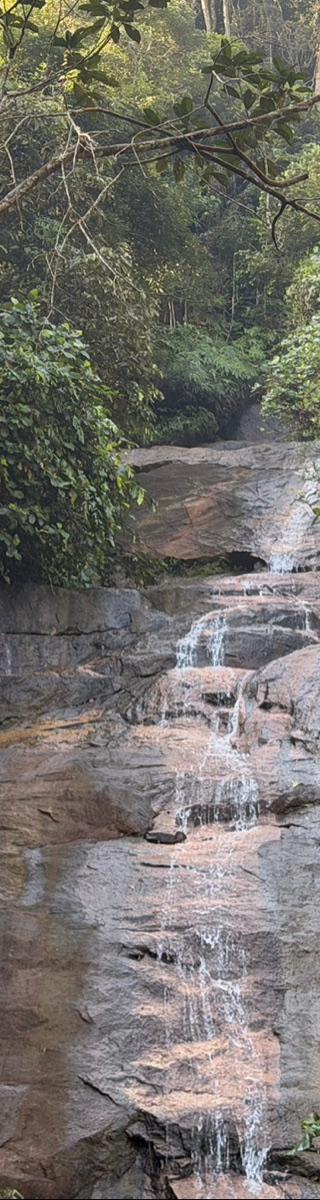
Trails
Gunung Meru (E approach)
Elevation profile↑748m ↓68m
4.59 km
Distance
2h 10m
Duration
+748 m
Gain
Gunung Meru (recorded)
Elevation profile↑699m ↓682m
9.56 km
Distance
3h 05m
Duration
+699 m
Gain
Gunung Meru (SE approach)
Elevation profile↑1059m ↓378m
8.22 km
Distance
3h 25m
Duration
+1059 m
Gain
Route data © OpenStreetMap contributors
Log this summit in Pacak
Track every climb, collect badges, share your story.
Coming soon on
App Store
Open in Pacak
Log this summit & track your climbs