Sarawak, Malaysia
Gunung Santubong
810 m
Hard
13.5 km
Distance
800 m
Elevation gain
No guide needed
Guide
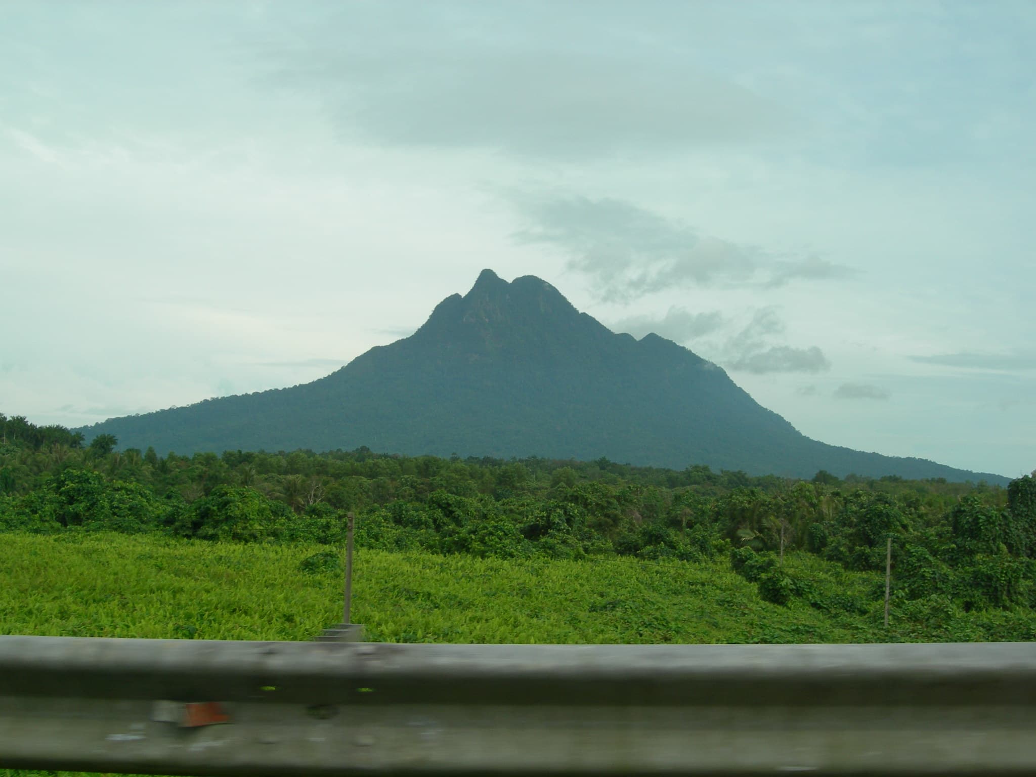
Sarawak's most iconic day hike — a steep 810 m jungle peak near Kuching with South China Sea panoramas and 21 aluminium ladders to the top.
About this mountain
Gunung Santubong (810 m) rises dramatically from near sea level on the Damai Peninsula 35 km north of Kuching, requiring 21 aluminium ladders to summit. The views over the South Ch…
FAQ
How high is Gunung Santubong?
Gunung Santubong stands 810 metres above sea level.
Where is Gunung Santubong?
Gunung Santubong is located in Sarawak, Malaysia.
How difficult is Gunung Santubong?
Gunung Santubong is rated hard, with a main route of about 13.5 km.
Do I need a permit to hike Gunung Santubong?
No permit is required to hike Gunung Santubong.
Do I need a guide for Gunung Santubong?
A guide is optional for Gunung Santubong.
When is the best time to hike Gunung Santubong?
Mar–Oct
Community
Be the first to summit and share a photo
More mountains in Sarawak
popularscenic
Log this summit in Pacak
Track every climb, collect badges, share your story.
Coming soon on
App Store
Open in Pacak
Log this summit & track your climbs