Pahang, Malaysia
✓ VerifiedGunung Tahan
2,187 m
ExtremePermit required
55 km
Distance
2,390 m
Elevation gain
Guide required
Guide
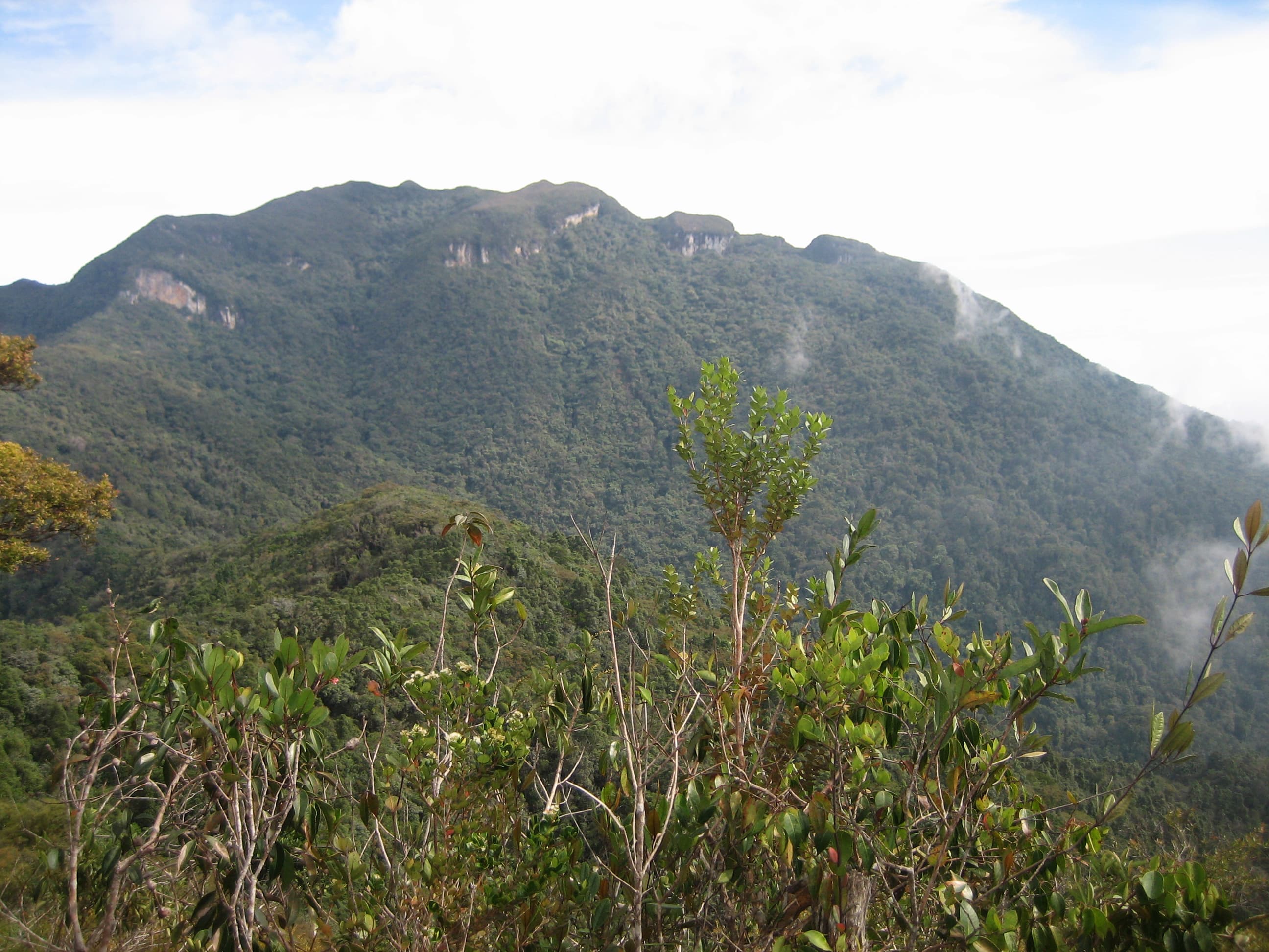
Peninsular Malaysia's highest peak, deep in ancient Taman Negara — a multi-day expedition for serious jungle trekkers.
About this mountain
Gunung Tahan at 2,187 m is the highest peak in Peninsular Malaysia and the centrepiece of Taman Negara, the world's oldest rainforest. The classic Kuala Tahan route is an epic 7–9 …
Part of these traverses
FAQ
How high is Gunung Tahan?
Gunung Tahan stands 2,187 metres above sea level.
Where is Gunung Tahan?
Gunung Tahan is located in Pahang, Malaysia.
How difficult is Gunung Tahan?
Gunung Tahan is rated extreme, with a main route of about 55 km.
Do I need a permit to hike Gunung Tahan?
Yes — a hiking permit is required for Gunung Tahan. Taman Negara permit required via Pahang State Park.
Do I need a guide for Gunung Tahan?
Yes — a licensed guide is required to climb Gunung Tahan. Licensed guide mandatory. 7-day expedition from Merapoh or Sungai Relau.
When is the best time to hike Gunung Tahan?
Mar–Sep
Community
2 summits on PacakBe the first to summit and share a photo
Trails
Merapoh To Merapoh (M2M)
Elevation profile↑2479m ↓472m
27.59 km
Distance
9h 39m
Duration
+2479 m
Gain
Route data © OpenStreetMap contributors
More mountains in Pahang
overnightscenic
Log this summit in Pacak
Track every climb, collect badges, share your story.
Coming soon on
App Store
Open in Pacak
Log this summit & track your climbs