
Perak, Malaysia
✓ VerifiedGunung Yong Belar
2,181 m
HardPermit required
17 km
Distance
1,100 m
Elevation gain
Guide required
Guide
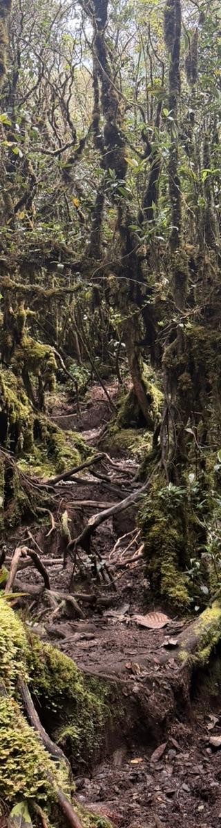
Third-highest Peninsular peak hidden in Royal Belum's ancient forest — a rewarding 2-day G7 climb through moss and mist.
About this mountain
Gunung Yong Belar (2,181 m) is the third-highest mountain in Peninsular Malaysia, sitting on the Perak–Kelantan border within the Royal Belum–Temenggor Forest Complex. The trail vi…
Part of these traverses
FAQ
How high is Gunung Yong Belar?
Gunung Yong Belar stands 2,181 metres above sea level.
Where is Gunung Yong Belar?
Gunung Yong Belar is located in Perak, Malaysia.
How difficult is Gunung Yong Belar?
Gunung Yong Belar is rated hard, with a main route of about 17 km.
Do I need a permit to hike Gunung Yong Belar?
Yes — a hiking permit is required for Gunung Yong Belar. Permit via Perak Forestry.
Do I need a guide for Gunung Yong Belar?
Yes — a licensed guide is required to climb Gunung Yong Belar. Licensed guide mandatory.
When is the best time to hike Gunung Yong Belar?
Mar–Sep
Community
Trails
Yong Belar Trail
Elevation profile↑728m ↓164m
6.24 km
Distance
2h 28m
Duration
+728 m
Gain
Gunung Yong Belar via Kebun Sayur
Elevation profile↑738m ↓149m
6.38 km
Distance
2h 30m
Duration
+738 m
Gain
Yong Belar - Junction Trail
Elevation profile↑743m ↓854m
6.17 km
Distance
2h 28m
Duration
+743 m
Gain
Route data © OpenStreetMap contributors
More mountains in Perak
overnighthidden
Log this summit in Pacak
Track every climb, collect badges, share your story.
Coming soon on
App Store
Open in Pacak
Log this summit & track your climbs